Seeing Disaster From Space: MicroNano Space Supports Emergency Rescue at Gyirong Port | Heart Capital Portfolio

When disaster strikes, satellites give rescue operations an extra pair of "eyes."
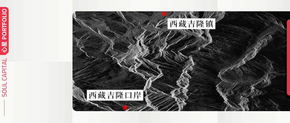
On the morning of August 26, a landslide disaster struck the Nepalese side of the border, causing significant casualties and missing persons at the Gyirong Port in Gyirong County, Shigatse City, Tibet. As of 6:00 PM on August 29, the disaster had claimed 16 lives and left 546 people missing. The cause of the disaster has now been determined, and rescue forces from all sides are racing against time to carry out emergency relief operations.
For sudden disasters like landslides, rescue teams on the ground often face blocked roads, complex weather conditions, and areas that are difficult to reach in time. Quickly grasping the overall changes in the disaster zone becomes a critical prerequisite for rescue assessment. In such situations, satellite remote sensing can continuously gather information about the disaster area from a broader range and higher vantage point, providing crucial supplementary support for ground rescue efforts.
Following the disaster, MicroNano Space, a Heart Capital portfolio company, rapidly activated its emergency response mechanism. Leveraging the "Dongpo" satellite constellation jointly developed with Huantian Wisdom — including Dongpo-11 (Agricultural Exchange Center-1), Dongpo-15 (Eye of Dongpo), Dongpo-16 (Jinjiang Xingyuan), Dongpo-17 (PowerChina-1 Cooperative Satellite), and Dongpo-19 (Chengdu University of Technology-1) — the company conducted emergency imaging observations of the affected area.
Capitalizing on the combined observational strengths of optical and SAR (Synthetic Aperture Radar) technology, the satellites successfully penetrated the plateau's complex meteorological conditions to precisely capture geomorphological changes in the disaster zone. At the same time, by leveraging pre- and post-disaster comparative remote sensing data, the system assisted all parties in analyzing the extent of damage and assessing the disaster situation, providing solid and reliable spatial data support for on-site rescue deployment and damage evaluation. Through pre- and post-disaster image comparison, geomorphological changes, affected areas, and key risk zones could be identified more intuitively, offering reference for road accessibility assessment, rescue force deployment, and secondary disaster prevention.
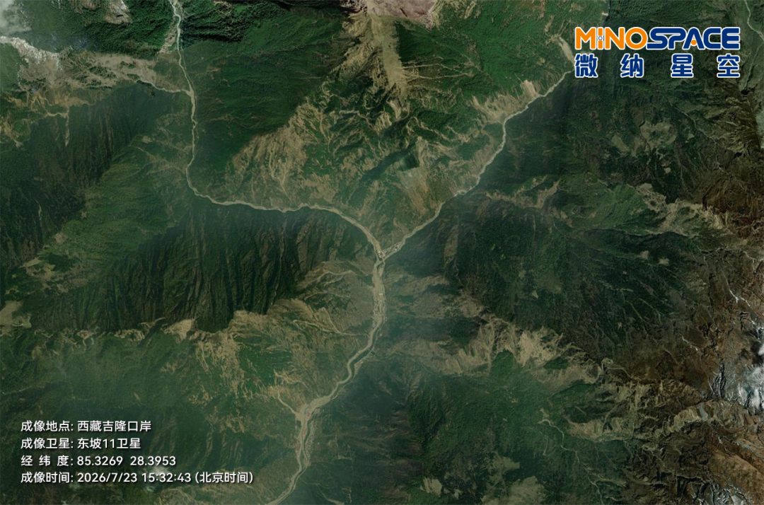
July 23, 15:32:43 — Dongpo-11 satellite captures pre-disaster optical imagery of Gyirong Port
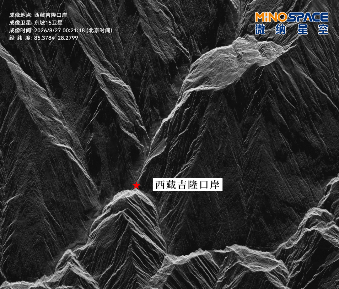
August 27, 00:21:18 — Dongpo-15 satellite captures post-disaster radar imagery of Gyirong Port
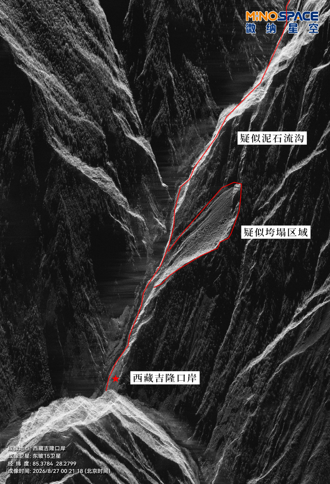
August 27, 00:21:18 — Dongpo-15 satellite captures post-disaster radar imagery of Gyirong Port
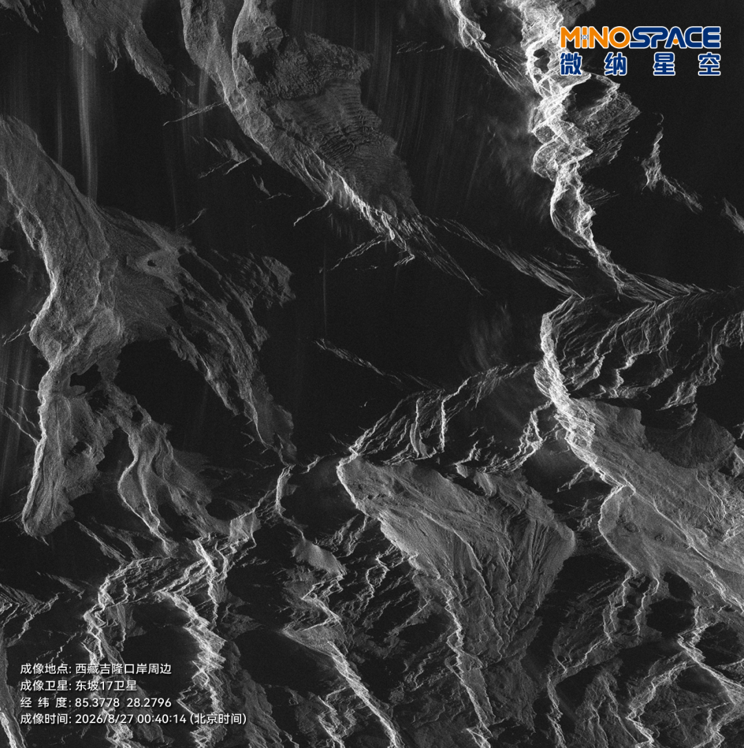
August 27, 00:40:14 — Dongpo-17 satellite captures post-disaster radar imagery of Gyirong Port
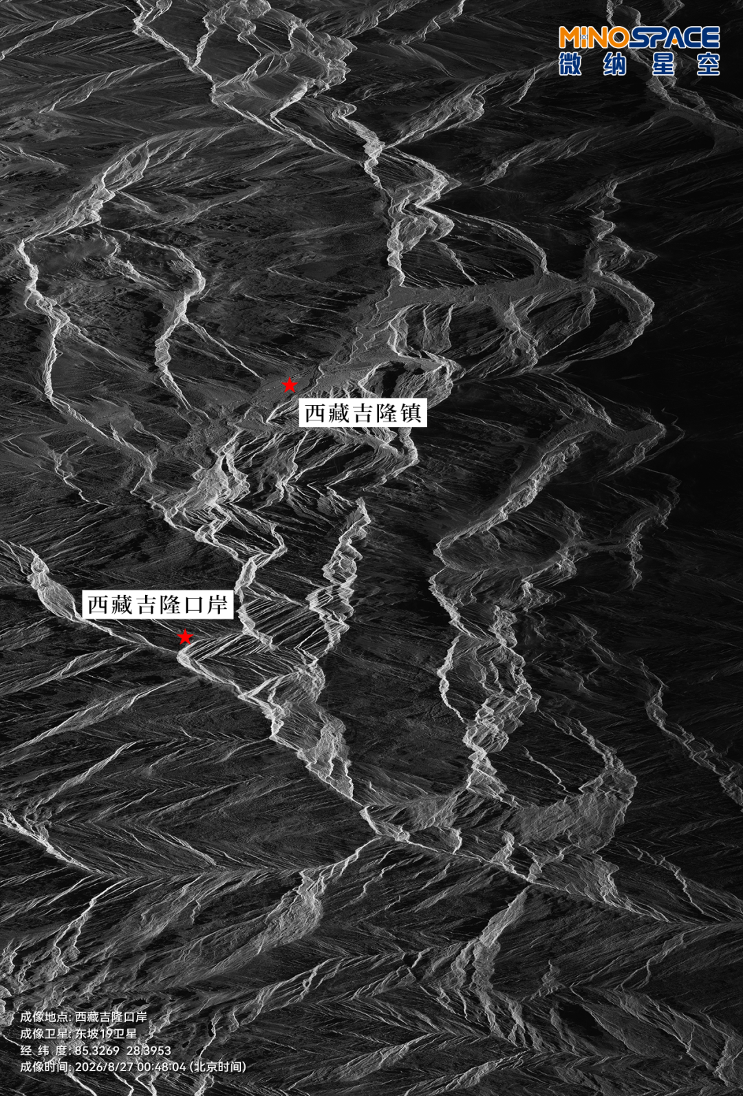
August 27, 00:48:04 — Dongpo-19 satellite captures post-disaster radar imagery of Gyirong Port
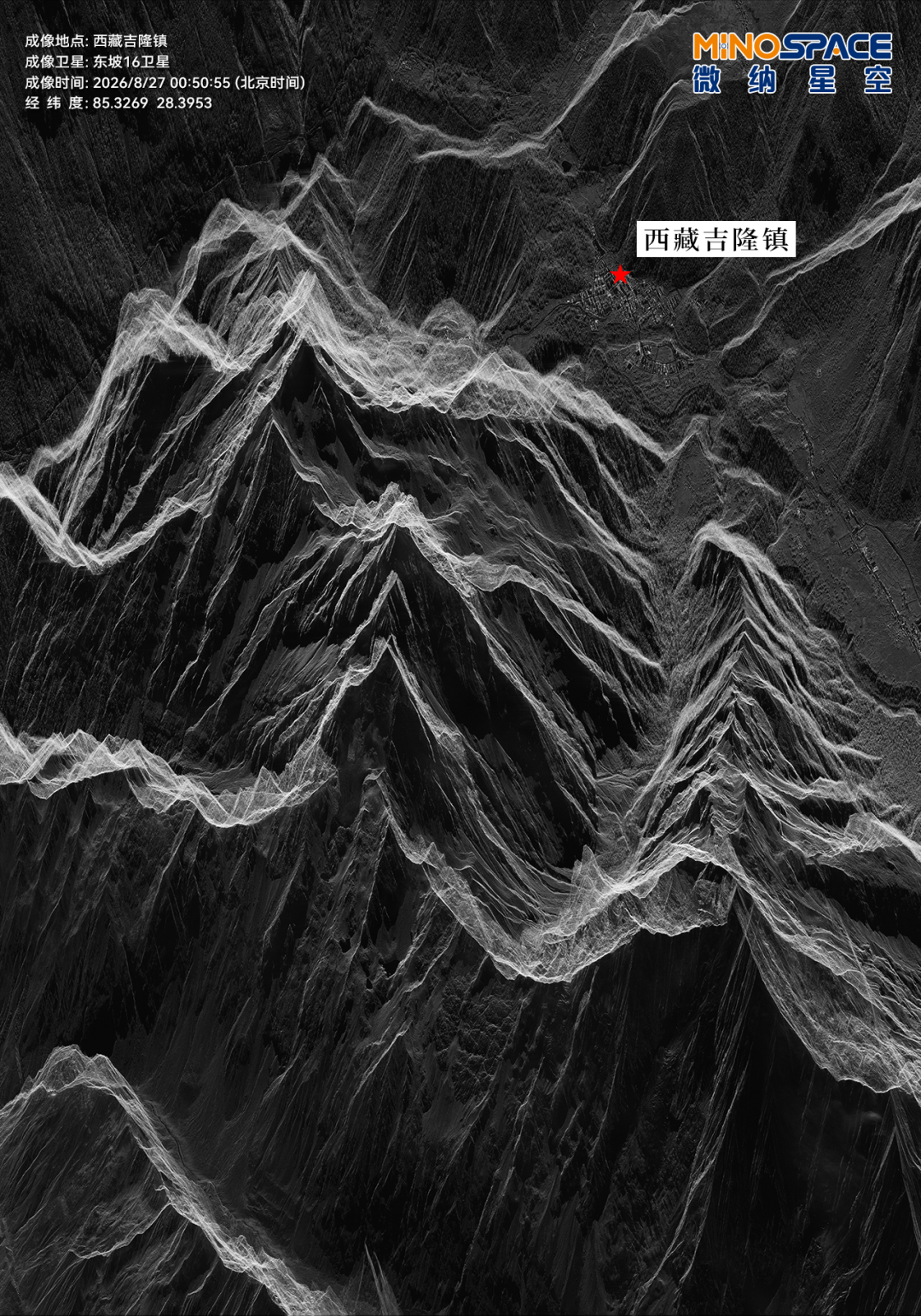
August 27, 00:50:55 — Dongpo-16 satellite captures post-disaster radar imagery of Gyirong Port
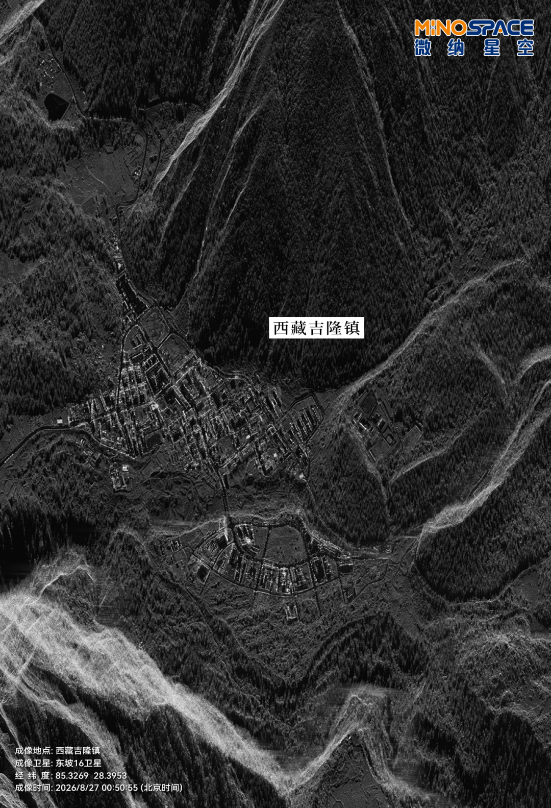
August 27, 00:50:55 — Dongpo-16 satellite captures post-disaster radar imagery of Gyirong Port
On August 27, the relevant remote sensing imagery was immediately shared with national emergency management authorities, providing timely and reliable spatial information support for disaster assessment, rescue force deployment, and secondary disaster prevention — fully contributing to the emergency relief efforts at Gyirong Port. When certain areas are temporarily inaccessible and ground visibility is limited, observations from space can arrive one step ahead. Satellites cannot replace on-site rescue operations, but they can help rescuers see the disaster situation faster and judge risks more accurately.
Currently, MicroNano Space remains fully committed to emergency preparedness, continuously coordinating satellite observation resources, closely tracking the evolution of the disaster situation, and responding to observation dispatch instructions as needed based on actual relief requirements. The company is fully dedicated to delivering spatial remote sensing information to support disaster assessment, emergency rescue, and disaster reduction and relief efforts — contributing aerospace capabilities to strengthen disaster prevention, mitigation, and emergency response.

Founded in 2022, Heart Capital is a venture capital fund focused on investing in early-stage Chinese technology startups.
The Heart Capital team is primarily composed of founding partners and core investors from Lightspeed China, alongside seasoned investors from industry backgrounds. The team's past investments include MetaX (688802.SH), Xpeng Motors (NYSE: XPEV, 09868.HK), Full Truck Alliance (NYSE: YMM), SUNMI (06810.HK), RoboSense (02498.HK), Ambiq Micro (NYSE: AMBQ), Hanshow Technology Co., Ltd. (301275.SZ), FinVolution (NYSE: FINV), HERE (NASDAQ: HERE), as well as LandSpace, MicroNano Space, Baichuan, Yunmanman Cold Chain Logistics, World Logistics, FanDeng Reading, and Lanhu.
Rooted in China with a global outlook, Heart Capital is committed to early-stage partnership with and support for entrepreneurial teams with the potential to become world-class companies in China's technology sector. Heart Capital champions the value of "heart," believing that technology can serve as a bridge connecting minds. Heart Capital looks forward to accompanying more young Chinese entrepreneurs onto the world stage.